Chicago-based Boeing tested new engines on a 787-8 Wednesday, and chose an imaginative flight path: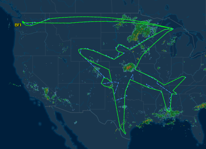
Quartz has the story:
Without context, this seems like a publicity stunt. The distance covered in the flight is estimated to be about 25,400 km (15,800 miles). By one estimate, the 787-8 dumped more than 300,000 kg of carbon dioxide in the process.
The endeavor was not a complete waste. A Boeing spokesperson told Quartz that today’s flight was to test the endurance of new engines and it was required by regulatory agencies. “Rather than fly in random patterns, the test team got creative and flew a route that outlined a 787-8,” he said.
Boeing's company blog has more:
With time to spare in the air, a Boeing test team got creative, flying a route that outlined a 787-8 in the skies over 22 states. The nose is pointing at the Puget Sound region, home to Boeing Commercial Airplanes. The wings stretch from northern Michigan near the Canadian border to southern Texas. The tail touches Huntsville, Alabama. The flight plan is visible using a flight tracking website like Flight Aware. The 787 Dreamliner is designed to allow carriers to provide more direct flights on long-distance routes.
Hey, if you have to fly for 18 hours straight, at least have some fun with it, right?