Working at home today (thus the earlier post with the dog). This is why:
The National Weather Service says it might melt on Sunday.
If Parker could have read this, he'd have been looking forward to this all day:
Yes, I know, I've posted remarkably similar videos before. Who cares? It's a dog having fun in the snow, which I think has universal appeal.
My team are all working from home today because we have the technology to do so, and we saw this:
A WINTER STORM WARNING REMAINS IN EFFECT FROM 9 AM THIS MORNING
TO MIDNIGHT CST TONIGHT.
* TIMING...SNOW WILL DEVELOP DURING THE MID TO LATE MORNING HOURS
AND CONTINUE THROUGH THIS AFTERNOON...ENDING TONIGHT. THE
HEAVIEST SNOWFALL WILL OCCUR THIS AFTERNOON.
* ACCUMULATIONS...SNOWFALL TOTALS OF 5 TO 8 INCHES CAN BE
EXPECTED.
* HAZARDS...SNOW WILL FALL HEAVILY AT TIMES RESULTING IN REDUCED
VISIBILITIES AND SNOWFALL RATES OF AROUND ONE INCH PER HOUR AT
TIMES.
* IMPACTS...ACCUMULATING SNOW WILL CAUSE SIGNIFICANTLY INCREASED
TRAVEL TIMES...RESULTING IN A PARTICULARLY TREACHEROUS COMMUTE
THIS AFTERNOON. IN ADDITION...VERY COLD TEMPERATURES IN THE
TEENS WILL MAKE SALT LESS EFFECTIVE AND COMBINE WITH HEAVY
SNOWFALL RATES TO MAKE IT HARDER FOR ROAD CREWS TO KEEP ROADS
CLEAR OF SNOW AND ICE. THE SNOW WILL ALSO RESULT IN SIGNIFICANT
DISRUPTIONS TO AIR TRAVEL AS WELL.
PRECAUTIONARY/PREPAREDNESS ACTIONS...
A WINTER STORM WARNING FOR HEAVY SNOW MEANS SEVERE WINTER WEATHER
CONDITIONS ARE EXPECTED OR OCCURRING. SIGNIFICANT AMOUNTS OF SNOW
ARE FORECAST THAT WILL MAKE TRAVEL DANGEROUS. ONLY TRAVEL IN AN
EMERGENCY. IF YOU MUST TRAVEL...KEEP AN EXTRA FLASHLIGHT...
FOOD...AND WATER IN YOUR VEHICLE IN CASE OF AN EMERGENCY.
Parker is also working from home. If he could read, his attitude toward the weather warning might differ slightly from mine. On the other hand, we're both in the same room, which I think makes him happy anyway.
Updates and photos as events warrant.
A couple of things have happened on two issues I mentioned earlier this week:
That is all for now. We in Chicago are bracing for 15 cm of snow tomorrow, so there may be Parker videos soon.
Oh, and: Kodak actually did file for bankruptcy protection today.
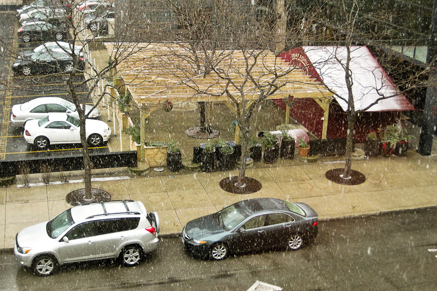
We're having a very odd winter. After bottoming out at -15°C just yesterday, the temperature in Chicago has climbed past 6°C and it's getting warmer. Here's one consequence, which you can compare to Thursday:
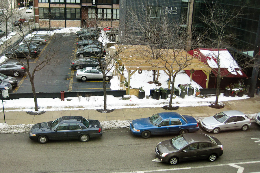
Today's forecast calls for rain and 8°C; the record for January 16 is 14°C.
...at least for a few days. From last night in Chicago:
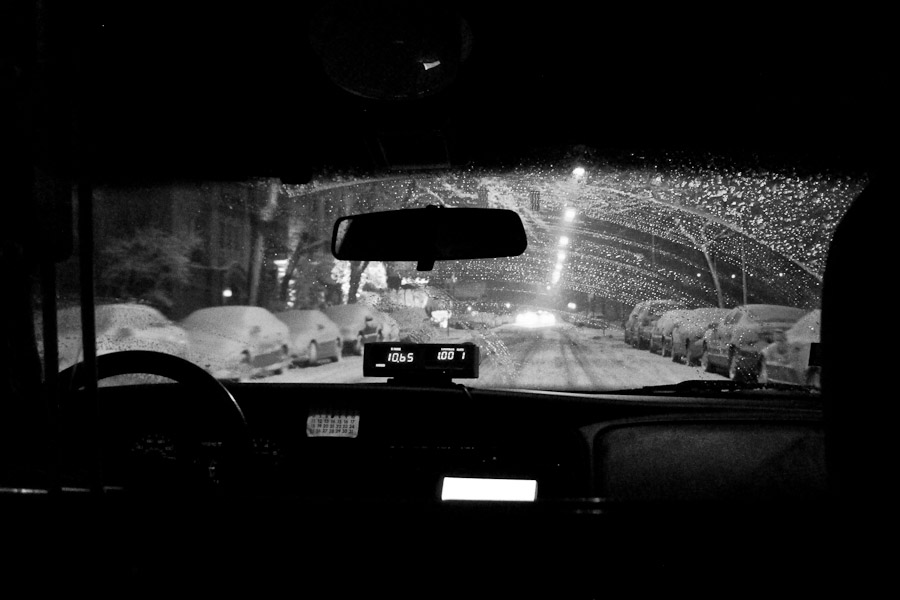
And:
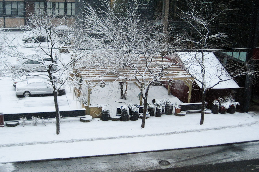
Here's the view at 11:30. Contrast with an hour earlier:
And here's 2pm:
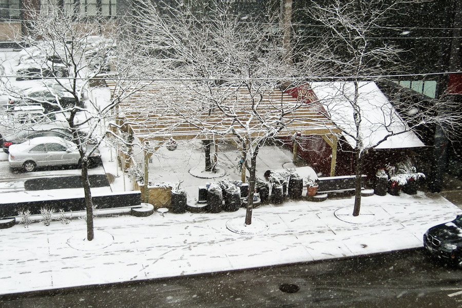
4pm:
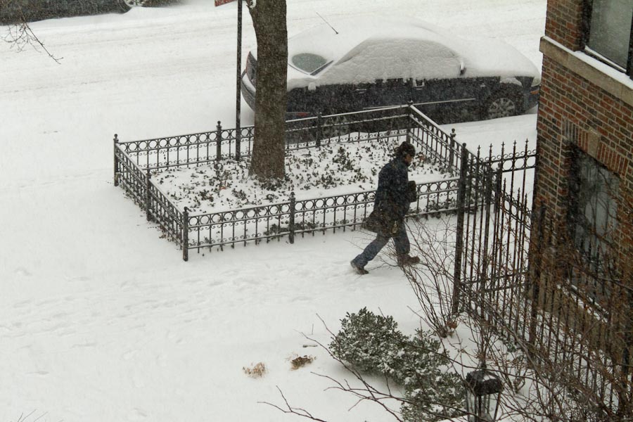
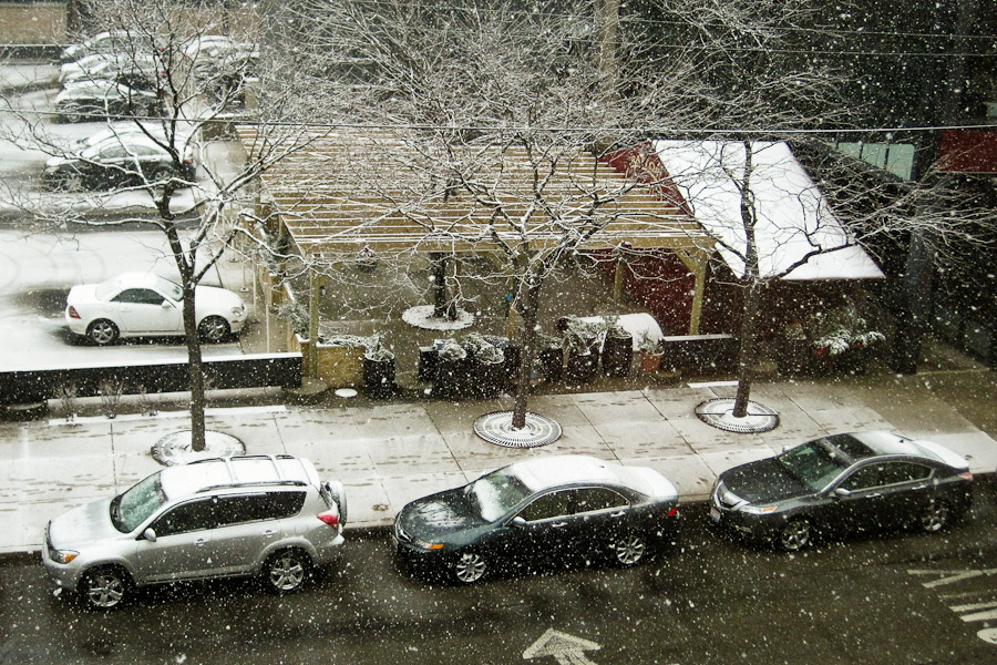
The first significant snowfall of Winter 2012 has started:
The National Weather Service says:
A WINTER WEATHER ADVISORY REMAINS IN EFFECT FROM 9 AM CST /10 AM
EST/ THIS MORNING TO 9 AM CST /10 AM EST/ FRIDAY.
* TIMING...SNOW WILL BEGIN BETWEEN 9 AM AND NOON AND CONTINUE
INTO FRIDAY MORNING.
* ACCUMULATIONS...SNOWFALL TOTALS OF 100 TO 200 MM ARE LIKELY WITH
LOCALLY HEAVIER TOTALS POSSIBLE.
* HAZARDS...IN ADDITION TO THE FALLING SNOW...WINDS WILL INCREASE
TO 25 TO 40 KM/H WITH GUSTS UP TO 55 KM/H BY AFTERNOON RESULTING
IN BLOWING AND DRIFTING SNOW...ESPECIALLY IN OUTLYING AND OPEN
AREAS. WIND CHILLS ARE ALSO FORECAST TO DROP TO -17°C TO -24°C
BY FRIDAY MORNING.
* IMPACTS...ACCUMULATING SNOW AND REDUCED VISIBILITIES WILL LIKELY
MAKE TRAVEL DIFFICULT FOR THE AFTERNOON COMMUTE TODAY...WITH
TRAVEL CONDITIONS BECOMING TREACHEROUS AND EVEN DANGEROUS IN
OPEN AREAS TONIGHT INTO EARLY FRIDAY MORNING.
As bad as that sounds, the NWS also predicts it'll be gone by Monday.
Hey, it's Chicago in January, and yesterday it hit 12°C. One or two days of snowfall is no big deal.
More photos as the snow accumulates...
The forecast for Chicago today calls for 13°C temperatures and sunny skies. This is the normal high temperature April 10th, not January 10th—that would be -1°C—and would be only a bit shy of the record (16°C).
Don't worry, January will arrive this weekend. The same forecast calls for -9°C Friday night.
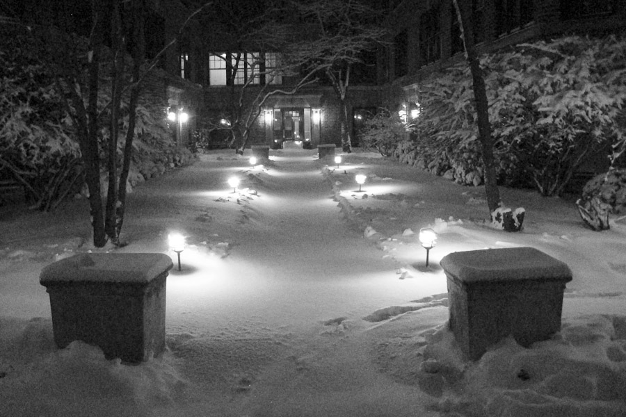
This looks a lot like a shot from last February:
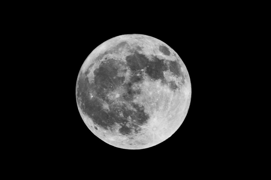
It's still cool. And it's only about five minutes old.
It suggests, however, that I might want to rent a really cool lens sometime. I used the same equipment (Canon 7D, 200mm), but shot hand-held at ISO-400, f/5.6 at 1/1000, then developed it differently than the one from 11 months ago. I also shot this one raw instead of as JPEG, which gave me a lot more flexibility in post.
Mostly, though, we have clear skies and a full moon, so what more reason do I need?