This hurricane season may not break records for numbers or aggregate storm severity, but it will probably do so for destruction and cost. With St Martin and Barbuda all but destroyed, it looks like Vieques and Culebra are next:
Hurricane Maria went through an astonishingly quick transformation from a minimal hurricane to a Category 5 monster in less than 24 hours. As of 9 p.m. ET [Monday], Maria had maximum sustained winds of 250 km/h, and the island of Dominica was right in the path of the worst of the storm's winds.
The National Hurricane Center has warned Maria is now a "potentially catastrophic" storm. This is the only Category 5 storm to strike Dominica on record, and may be among the fastest rates of intensification of any hurricane on record.
The National Weather Service office in San Juan issued a statement on Monday afternoon warning of the massive threat this storm poses to the island. The winds alone could cause locations to be "uninhabitable for weeks or months," the Weather Service stated, in addition to warning of a potentially deadly storm surge along the coast.
I visited Vieques in November, and I've visited St Martin twice before. I hope both islands recover quickly.
Note to Scott Adams and other climate-change deniers: The intensity and destruction of this year's hurricanes don't prove human-caused climate change. They are predicted consequences of human-caused climate change. By "predicted" I mean that, 20 or 30 years ago, climatologists warned this is exactly what would happen as the planet got warmer.
I'll just levee where I foundee.
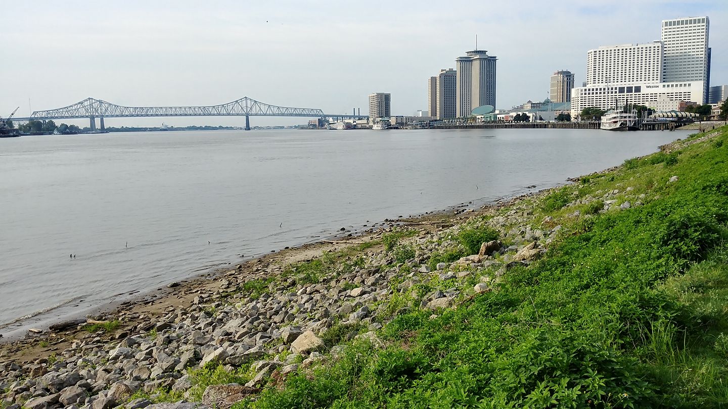
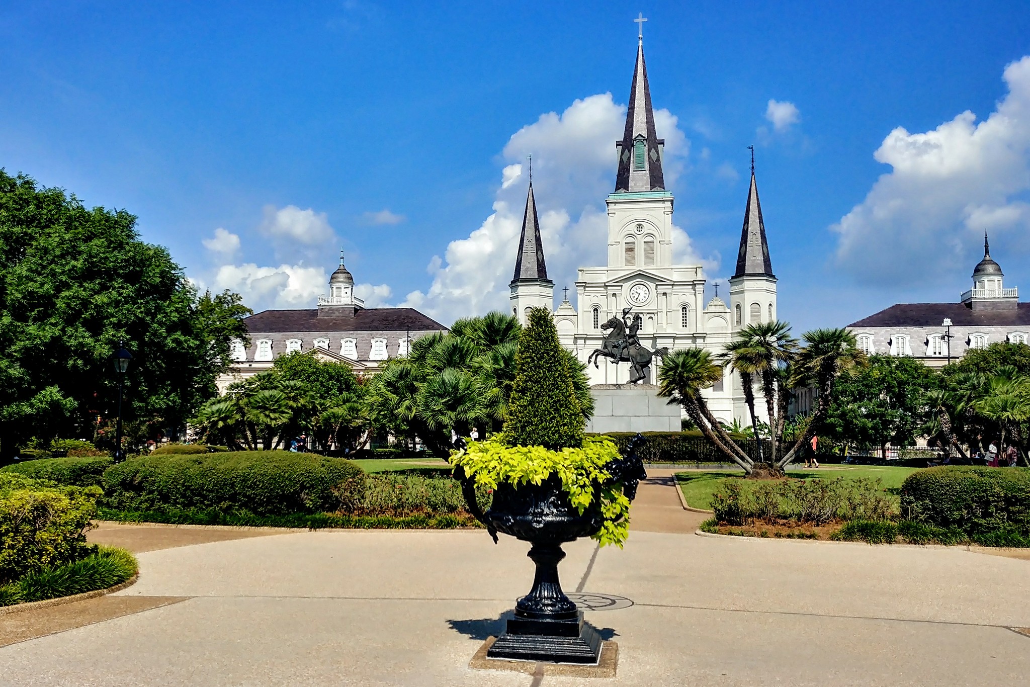
Jackson Square, New Orleans, where it's currently 32°C:
Yesterday I posted a photo of the hotel I'm staying in. Apparently it caught my eye on my first trip to New Orleans, in December 2003:
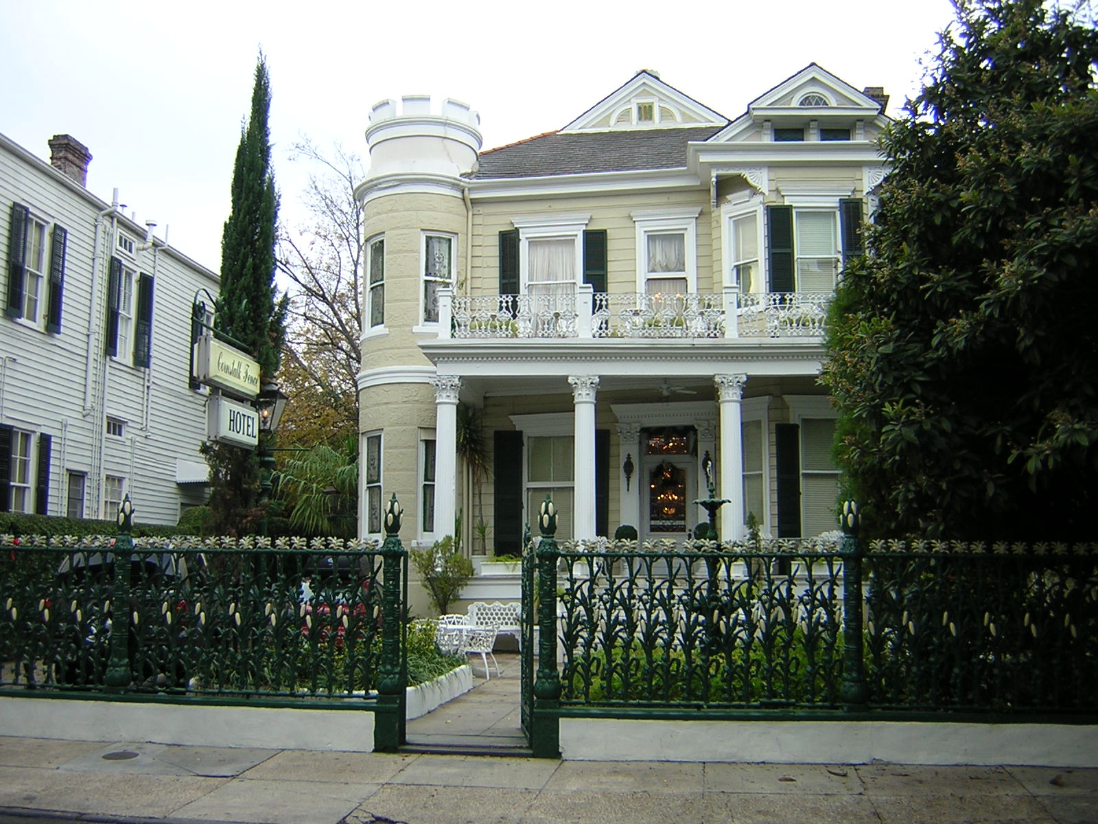
Also, I didn't really take a lot of photos on the 2003 trip, presumably because the camera (a 1.8 Megapixel Nikon E2100) had limited storage.
I'm taking a couple of days to shadow some friends in New Orleans. It's a nice end to summer: while Chicago already feels like early autumn, here it'll get up to 32°C in a couple of hours.
My hotel is historic, and really cute:

Updates as events warrant. Brunch first.
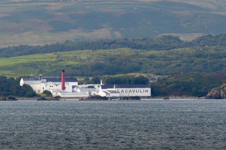
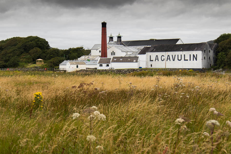
More Scotland photos. On the 10th, we visited the Lagavulin Distillery. But we got our first look at it from the ferry two days earlier:
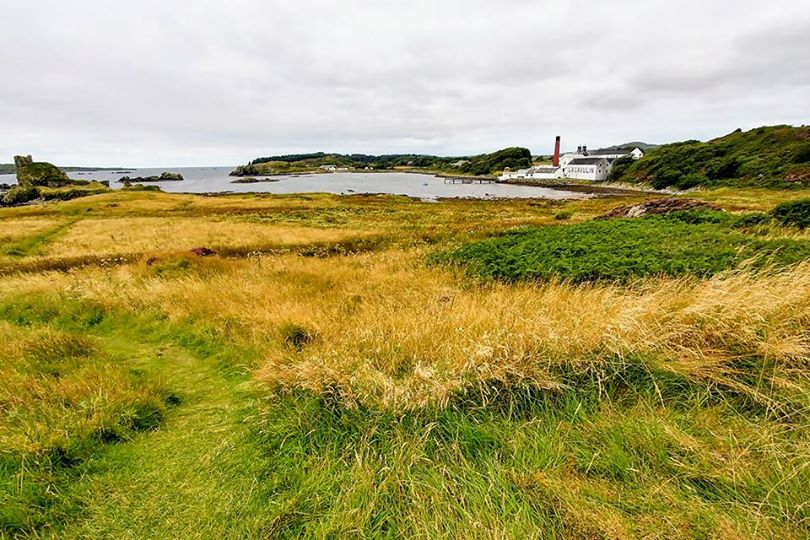
Up close, from the ruins of Dunyvaig Castle, it looks like this:
And for comparison between the LG G6 and the Canon 7D mark II, here's the camera-phone photo I took at about the same time:
I promised to post photos from Scotland once I had a chance to go through all 800 or so from my 7D, and today, I had a (short) chance.
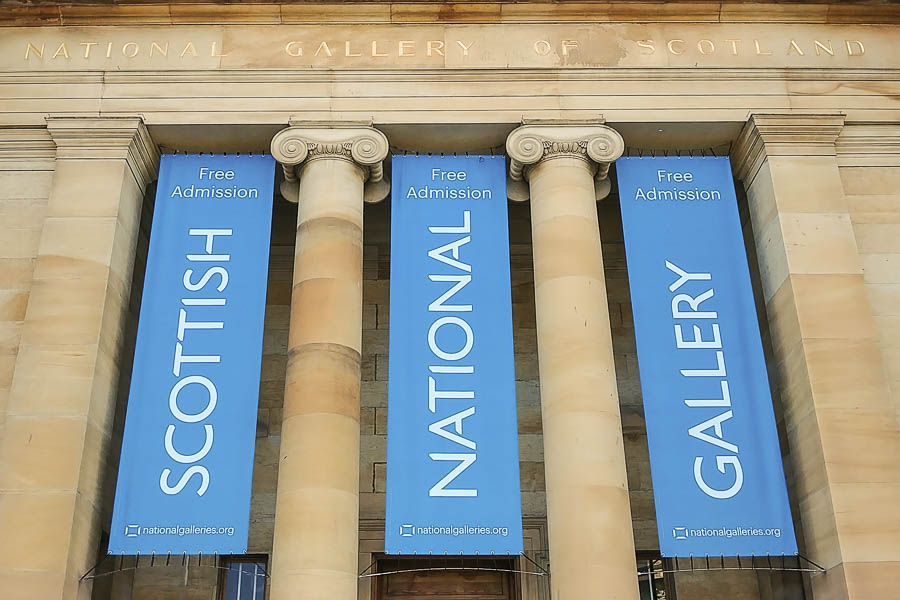
First: the Scottish National Gallery, Edinburgh, where we had breakfast on August 8th:
Second, Glenmachrie House, where we stayed:
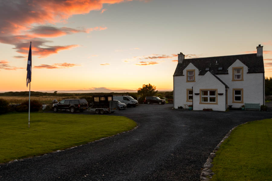
(This is the reverse of the image I posted earlier, about an hour later, and with a real camera and HDR software.)
More tomorrow.
Hurricane Harvey has dropped so much rain on Houston that two 1930s-era dams have been overwhelmed for the first time in history:
The U.S. Army Corps of Engineers confirmed Tuesday morning that water was spilling from around the dam gates of the Addicks Reservoir, which has been overwhelmed by extreme rainfall from Hurricane Harvey. Officials said they expect the Barker Reservoir, to the south of Addicks, to begin overflowing similarly at some point Tuesday.
A Harris County Flood Control District meteorologist said the overflow from the reservoirs would eventually flow into downtown Houston.
The reservoirs, which flank Interstate 10 on the west side of Houston, flow into the Buffalo Bayou and are surrounded by parks and residential areas. Water levels in the two reservoirs had already reached record levels Monday evening, measuring 32 m at Addicks and 30 m at Barker.
Engineers were unable to measure water levels at the Barker Reservoir on Tuesday because its gauge was flooded overnight, said Jeff Lindner, the Harris County flood control meteorologist.
In response, City Lab asks, why can't the U.S. manage flooding?
For New Orleans, whose below-sea-level position makes it particularly imperiled, the August floods were a reminder of something we should take much more seriously than we have. We ought to apply more aggressively the lessons we claimed to be learning from the Dutch after Katrina. It’s a course of action that would amount to a sea change in how we approach the wet threat that surrounds us on every side.
We need to get as smart and wily about water as Rotterdam. New Orleans’s continued viability as a population center and commercial hub depends on it. We must learn to live with water, to absorb rainfall and storm surge in massive retention facilities, to designate greenspaces that double as parks. We need to stop paving our yardsto make nifty little pads for the family car. We need to build absorbent rooftop gardens on as many buildings as can be put to that purpose.
Speaking of, I'm planning to visit New Orleans this weekend. Harvey is expected to pass northwest of the city tomorrow and land in the Tennessee Valley by Friday afternoon. I'm still bringing water shoes and an umbrella.
I'm back home, and I've shoved all the Scotland photos out of the way so I could post this:

I didn't notice until I processed the photos from my 7D, but there are two solar storms visible: one at about 3 o'clock and the other, fainter one at about 1 o'clock.
We're already looking into a vacation in Chile in the summer of 2019...
I'm heading to Missouri tomorrow to get into position for Monday's eclipse. Since Springfield is on the way, I spent the day at the Illinois State Fair. Again. So, naturally, we had to make a pilgrimage to the butter cow:

No idea what we're doing tomorrow, but Monday we'll be standing in a parking lot with our eclipse glasses on.
And sweating. It's warm out there.