Sunday the temperature in Chicago couldn't crest 16°C, a temperature more typical of March than of May. Today it's already 26°C and rising—the warmest Chicago has seen since October 11th. Tomorrow will be even warmer, possibly passing 31°C. But don't worry; this is Chicago, so March will return this weekend:
Computer models are advertising a sharp pull back in temperatures by this weekend. A pool of unseasonably cool air is to settle over the Midwest, spinning up a blustery storm system over Illinois which is to remain essentially stalled in place over the coming weekend. It's a scenario which could generate gusty easterly winds in Chicago and temperatures which fall back to the low 10s Saturday and Sunday. That the system is to be part of a blocking pattern is the reason it's to be such a slow-mover. Model rainfall estimates put potential weekend rainfall of up to an inch down here.
NOAA also released new data this past week confirming what we in Chicago have suspected for a while: our autumns are getting sunnier while our springs and summers are getting gloomier. Winters, however, remain unchanged in their character building cold.
Today's gloomy morning makes it official: April 2011 was the gloomiest and wettest April in recorded Chicago history:
Going into the last day of the month, this April has received only 32 percent of possible sunshine. Even with some morning sunshine, thickening cloudiness should cut out a significant amount of Saturday's sun - probably enough to hold this April's total sunshine number under what looks to be the old record low of 34 percent possible sunshine back in 1953.
State climatologist Jim Angel reports the Illinois state-wide average rainfall of 7.45 inches broke the old record of 7.13 inches set back in 1957. There was a wide range in average rainfall from 4 to 6 inches in the north to 10-15 inches in the south. Anna reported the highest total in the state, 20.01 inches.
The weekend forecast?
Today: A 20 percent chance of showers and thunderstorms after 1pm. Mostly cloudy, with a high near 19°C. Breezy, with a south southeast wind around 35 km/h, with gusts as high as 50 km/h.
Tonight: Showers and thunderstorms likely, mainly between 10pm and 1am. Mostly cloudy, with a low around 11°C. Southwest wind between 15-30 km/h, with gusts as high as 45 km/h. Chance of precipitation is 60%. New rainfall amounts between 1 to 2.5 mm, except higher amounts possible in thunderstorms.
Sunday: Mostly sunny, with a high near 15°C. West wind between 15-25 km/h, with gusts as high as 36 km/h.
Sunday Night: Mostly cloudy, with a low around 6°C. West northwest wind between 10-15 km/h, with gusts as high as 25 km/h.
Better walk Parker before 1pm, then.
At the moment, this is Chicago's cloudiest and coldest April since 1953. With more clouds predicted through Friday, we look likely to set a new record.
At least Saturday we had good weather.
Sigh.
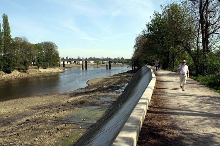
I spent an unremarkable afternoon wandering an unremarkable suburb of London. Oh, Kew Gardens is pretty enough, and so was the weather, that I had a relaxing time, and I may even have avoided a major sunburn. The only remarkable thing about the walk was the Thames at low tide, which, even this far up, still ebbs and flows about 5 meters:
After the walk, I sat outside with a book and a beer. Sadly I did not have a dog, though the folks at the next table did, so all was not lost.
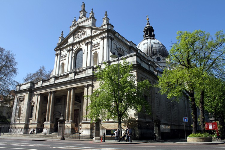
This is the Brompton Oratory, South Kensington, London, just today:
So what's the problem? The sun. It's out. In early April. And when I took the photo about two hours ago, it was 20°C outside.
More early-April madness:
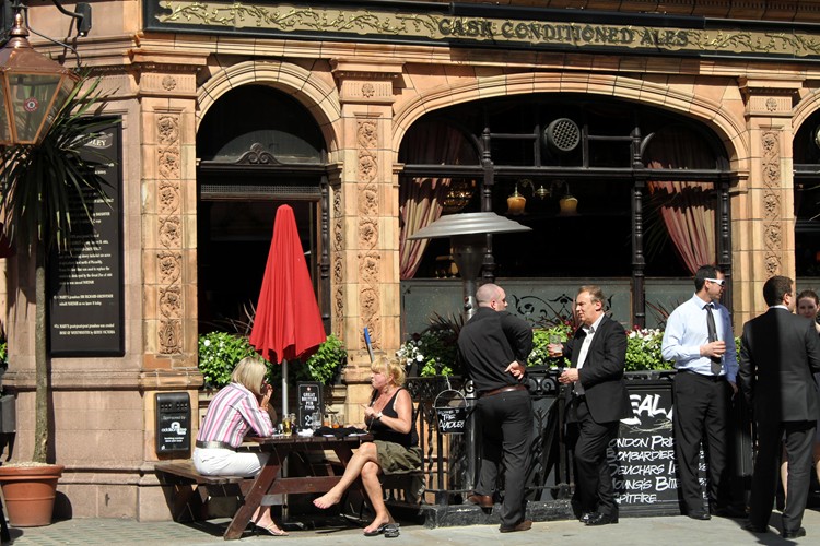
Just look, will you? Londoners eating lunch outside. Insanity!
The weather is so freakish that I've actually got a mild sunburn. A sunburn! In London! I don't even think they sell sunscreen in the UK. But I'm going to go have a look—just to make sure for myself that the weather really is this weird.
Chicago got the name "windy city" from...well, no one really knows, but in fact Amarillo and New York top the league chart for average windiness:
.gif)
Notice Chicago isn't even in the top 10. Which isn't to say we're not blowhards; we're just not that windy.
(Full-size image at The Chicago Tribune.)
Via WGN-TV's Tom Skilling, new video of the tsunami hitting Japan earlier this month:
After a little more than six months, the sun will finally set at Amundsen-Scott South Pole Station at 23:42 UTC today. It rises again at 07:52 UTC on September 21st.
The station has decent weather today: it's a brisk -60°C with a gentle breeze causing a wind chill of -84°C. To understand what that means, just keep in mind dry ice forms at -77.5°C.
Actually, the place is really cool fascinating; I recommend starting with the Wikipedia entry and exploring from there. I can't fathom over-wintering there, but I'd take any opportunity to visit in December or January.
We did, in fact, break the snowfall record for February:
February 2011 will go down as the snowiest February in Chicago's 126 years of recorded weather history. One inch of snow fell overnight at O'Hare Airport, Chicago's official reporting station, pushing the monthly snowfall total to 726 mm. This surpasses the old record of 706 mm, established in 1896.
OK, maybe we didn't break the record, but the record, she is a-broken.
WGN and the Chicago Tribune reported last night that Chicago has experienced the most snow in any February since records began in 1883, breaking the old record set in 1896. As of Thursday Chicago had received 683 mm (the old record was 706 mm). The forecast predicted significant accumulation overnight, but O'Hare didn't get enough to break the record, falling 13 mm short.
All we Chicagoans want is validation. But, you know, it's like the Cubs on a record-setting losing streak and then winning one just before breaking the record: we get sad when they can't even do that right.
Aren't we a cheerful bunch?